Top Line: While some states have more forested BLM land than does Oregon, in terms of biomass (think lots of big trees) Oregon’s BLM lands are likely more carbon-rich than all of the others combined.

Figure 1. Who knew the BLM had forests, let alone a grove of giant sequoias?! Source: Bureau of Land Management.
The Bureau of Land Management, an agency of the Department of the Interior, administers 244.3 million acres of surface lands or 14.3 percent (one-seventh) of the total land (not including saltwater) area of the United States. (The BLM also administers 57.2 million acres of “split estate”—only underground minerals.) Most Americans—if they are even aware of BLM public lands—are not aware that a significant portion of BLM lands are actually forested. Many mistakenly think that all federal forestlands are part of the National Forest System, administered by the USDA Forest Service. Oh, if only that were the case, since the basic federal statutes pertaining to the BLM are inferior to those that apply to the Forest Service.
Amount of Forested Land on Bureau of Land Management Holdings
Maps 1 and 2 show the extent of BLM forested lands in the West and Alaska.
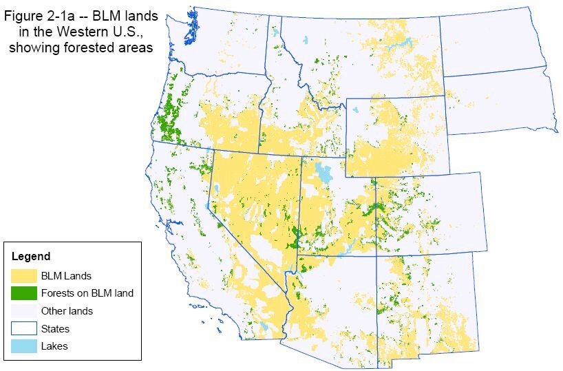
Map 1. Forested and nonforested Bureau of Land Management holdings in the West, excluding Alaska. Source: USDI Bureau of Land Management, Forests Defined (web page).

Map 2. Forested and nonforested Bureau of Land Management holdings in Alaska. Source: USDI Bureau of Land Management, Forests Defined (web page).
According to the BLM’s Public Land Statistics 2021 report, ~31.4 million acres or ~13 percent of BLM lands are forested (Table 1).

The BLM’s inventory of its forested lands is based on the USGS National Land Cover Database (NLCD), which defines different kinds of forests as follows:
Deciduous Forest—areas dominated by trees generally greater than 5 meters tall, and greater than 20% of total vegetation cover. More than 75% of the tree species shed foliage simultaneously in response to seasonal change.
Evergreen Forest—areas dominated by trees generally greater than 5 meters tall, and greater than 20% of total vegetation cover. More than 75% of the tree species maintain their leaves all year. Canopy is never without green foliage.
Mixed Forest—areas dominated by trees generally greater than 5 meters tall, and greater than 20% of total vegetation cover. Neither deciduous nor evergreen species are greater than 75% of total tree cover.
Woody Wetlands—areas where forest or shrubland vegetation accounts for greater than 20% of vegetative cover and the soil or substrate is periodically saturated with or covered with water.
But the BLM’s Forests and Woodlands web page gives a different number: it says the agency has “close to 58 million acres of forest and woodlands . . . across 12 western states and Alaska,” or ~24 percent of all BLM lands.
The US Forest Service gives yet another figure. According to its Forest Inventory and Analysis (FIA), the BLM has 37,559,000 forested acres, ~15% of all BLM lands. FIA data is derived from a nationwide network of forest plots and other sources. The FIA defines “forest” as land with at least 10 percent tree cover. This definition appears to include the NLCD classification of “woody wetlands.”
Why the Discrepancies?
Why the discrepancy between the BLM’s estimate of 31.4 million acres of forests on BLM lands and the Forest Service’s FIA estimate of 37.6 million acres of forests on BLM lands? The former uses a minimum of 20 percent tree cover to define forested lands, while the latter uses a minimum of 10 percent tree cover. From the perspectives of climate change mitigation (carbon storage and sequestration), biological diversity conservation, and watershed protection, the more generous definition (the latter) is appropriate.
The BLM’s other claim to have “close to 58 million acres of forest and woodlands” is harder to explain. My guess is that these more expansive numbers were generated by local BLM foresters asked from above to define the extents of their bureaucratic domains.
Extent of BLM Forestlands by State
The information below was reported from BLM “state” offices.
Alaska: 20 to 30 million acres of forests and woodlands.

Figure 2. A BLM forest in Alaska. Source: Bureau of Land Management.
California: 1.6 million forest acres, of which 900,000 acres are woodlands, 200,000 acres are commercial forest, and 100,000 acres are noncommercial forest. Throughout the state the major species are Douglas-fir, giant sequoia, Jeffery pine, numerous oak species, pinyon pine, ponderosa pine, quaking aspen, redwood, and western juniper.

Figure 3. A giant sequoia on BLM land in California. Source: Bureau of Land Management.
Colorado: 3.5 to 4 million acres of forested lands. More than 2.5 million acres are considered woodlands, dominated by piñon, juniper, and oak. The remaining forested acres consist of traditional commercial tree species such as ponderosa pine, lodgepole pine, and Douglas-fir.

Figure 4. A lodgepole pine on BLM land in Colorado. Source: Bureau of Land Management.
Idaho: 770,000 acres of forestland and approximately 300,000 acres of woodland (pinyon-juniper), including whitebark pine trees more than four hundred years old, which BLM considers “common.”

Figure 5. A BLM forest in Idaho. Source: Bureau of Land Management.
Montana (also North Dakota and South Dakota): 1.3 million acres of forestland, with 900,000 acres of commercial forestland and the rest considered woodlands. The major tree species found throughout the region include Douglas-fir, ponderosa pine, lodgepole pine, spruce, subalpine fir, limber pine, whitebark pine, aspen, and juniper.

Figure 6. A BLM woodland in Montana. Source: Bureau of Land Management.
Nevada: No specific acreage given.

Figure 7. A BLM quaking aspen woodland in Nevada. Source: Bureau of Land Management.
New Mexico (also Kansas, Oklahoma, and Texas): 2 million acres of forests and woodlands, ranging from mixed conifer and aspen in the southern Rocky Mountains near Taos to ponderosa pine in western New Mexico, to oak and juniper savannahs along the border with Mexico.

Figure 8. A BLM woodland in New Mexico. Source: Bureau of Land Management.
Oregon (and Washington): The acreage of BLM forestlands in Washington is extremely low. For Oregon, the BLM administers ~2.4 million acres. There are also a few hundred thousand acres of BLM lands in eastern Oregon not included in this figure. While a few states have more forested acres than Oregon, on a per-acre basis the Oregon acres contain the most carbon.

Figure 9. A western hemlock in Oregon. Source: Bureau of Land Management.
Utah: 6 million acres of pinyon-juniper woodlands and another 700,000 acres of diverse forestland.
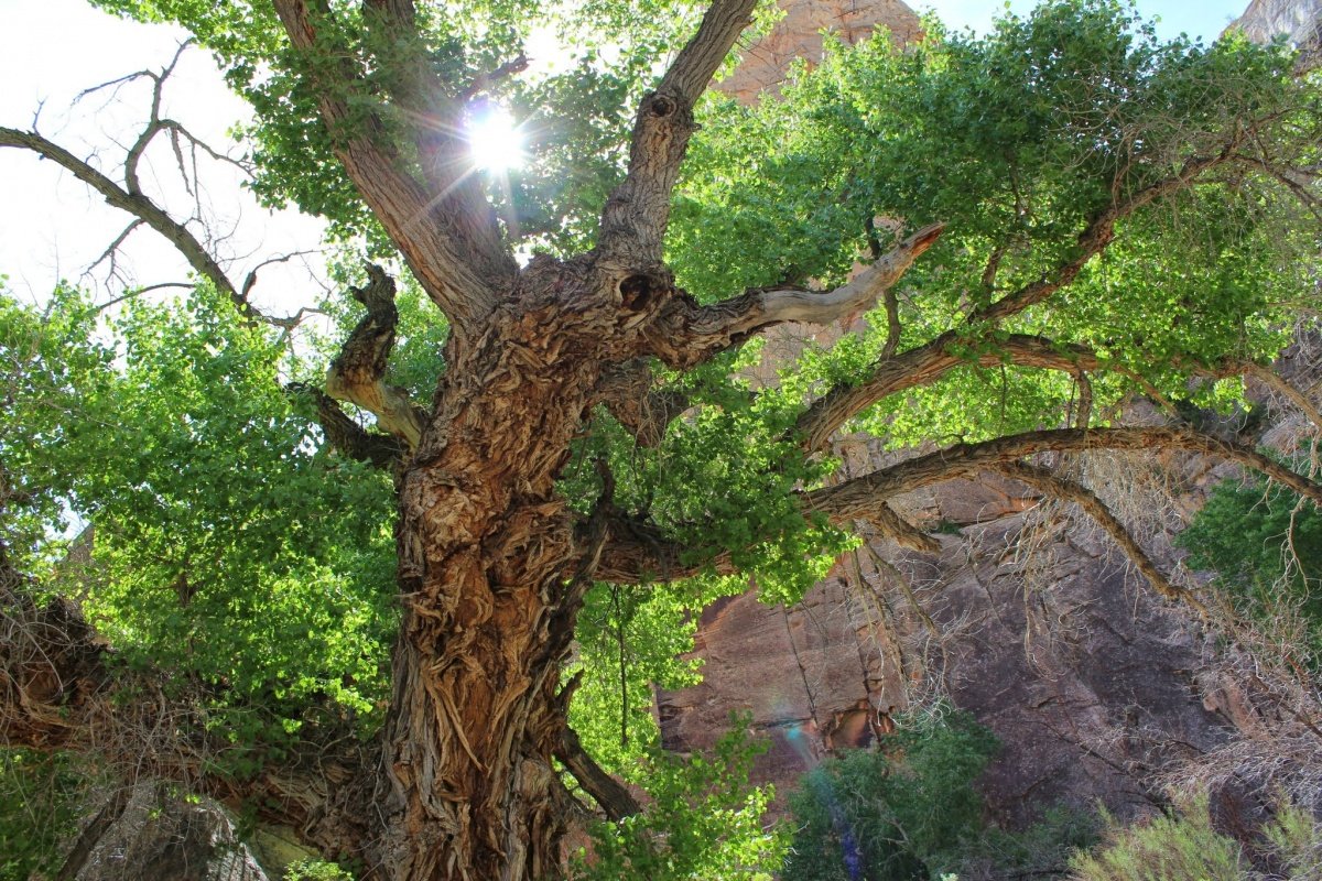
Figure 10. A BLM forest in Utah. Source: Bureau of Land Management.
Wyoming: 1.3 million acres of forests and woodlands. Approximately 500,000 acres are considered forestland and the other 800,000 acres are woodlands. Includes 11,000 acres of whitebark pine stands.

Figure 11. A BLM forest in Wyoming. Source: Bureau of Land Management.
Bottom Line: Not all federal forestlands are administered by the USDA Forest Service within the National Forest System. Often, many in the national conservation community, through ignorance or laziness, refer to all federal public forestlands as “national forests” rather than “federal forests.”
For More Information
Multi-Resolution Land Characteristics Consortium, National Land Cover Database Class Legend and Description (web page).
Oswalt, Sonja N., W. Brad Smith, Patrick D. Miles, and Scott A. Pugh, coordinators. 2019. Forest Resources of the United States, 2017. Gen. Tech. Rep. WO-97. Washington, DC: U.S. Department of Agriculture, Forest Service, Washington Office.
USDA Forest Service, Forest Inventory and Analysis National Program (web page).
USDI Bureau of Land Management, BLM Alaska Forests and Woodlands (web page).
———, BLM Colorado Forests and Woodlands (web page).
———, BLM Idaho Forests and Woodlands (web page).
———, BLM Montana-Dakotas Forests and Woodlands (web page).
———, BLM Nevada Forests and Woodlands (web page).
———, BLM New Mexico Forests and Woodlands (web page).
———, BLM Utah Forests and Woodlands (web page).
———, BLM Wyoming Forests and Woodlands (web page).
———, California Forests and Woodlands (web page).
———, Forests and Woodlands (web page).
———, O&C Lands (web page).
———. June 2022. Public Land Statistics 2021, Tables 1-3, 2-5, and 2-6.
USDI Geological Survey, National Land Cover Database (web page).